Cable telemetric geonavigational system “Pilot BPG26-02”
Designed to control well drilling under specified trajectory on the basis of changes in bottom-hole conditions
Monitoring system allows
- Controlling angular settings of the well’s trajectory in open shaft and in composition with bottom-hole assembly
- Determine deviation of angular positioning in the process of drilling
- Measure natural radioactivity of the rocks
- Measure azimuthal distribution of apparent specific resistance (conductivity) of rock, penetrating depth of reach – 1m
- Analyzes mechanical vibrations and temperature in inlet zone
- Calculates and build wells’ trajectory, also forecasting drilled well trajectory based on own mathematical models
- Executes efficient analysis physical-mechanical and lithoLagical properties of rock
- Executes continuous overlook of validity of changes and transferring information based on integral variables (magnetic field vector setting and gravity of Earth, current leak in communication lines, vibration level of acceleration, tested information)
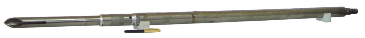
System components
- Land-based interface unit
- Remote power source
- Borehole mobile probe. Dimension – (Ø35·3080) mm, weight – 20.4 kg
- Borehole stationary probe. Max diameter 164mm, length 6m
- Body (dimension varies based components)
- Specialized cable input
- Specialized geophysical winch